
During this one-day-workshop you will be introduced to methods for the analysis, synthesis and optimization of urban layouts. We will cover computational generation of the street network, parcellation and the building form, based on the existing urban context and various design goals. You learn how to analyze street networks effectively, and we show you how to compare and optimize the generated designs systematically. For this purpose we use Grasshopper for Rhino3D with the plugin DecodingSpaces-Toolbox, and a new Design-Space-Exploration tool. The methods are demonstrated by realistic case studies in an existing urban environments.
This workshop is intended for both practitioners and researchers interested in rapid context aware generation of urban layouts. The presented workflow let you computationally explore the design options of new urban development area with the possibility to assess the site potential and inform the early planning stages. The presented DeCodingSpaces-Toolbox for Grasshopper is a collection of analytical and generative components for algorithmic architectural and urban planning. The toolbox is free software released by the Computational Planning Group (CPlan).
The workshop on Adaptive Urban Layout Optimization in Grasshopper is hosted by:
SimAUD 2019, Atlanta – USA, School of Architecture, Georgia Tech, 7. April 2019

Requirements
- Windows 10
- Rhino 6 (64bit)
- Required Grasshopper plugins
- DeCodingSpaces Toolbox for Grasshopper build 2019.04
- DeCodingSpaces Explorer 1.2
- Anemone
- Human
- Metahopper
Install instructions
Unblocking plugins
After downloading the RequiredGHPlugins_SimAUD19.zip file, check if its unblocked before extracting the zip archive. Right click on the file > Properties > select unblock > select ok

Install components
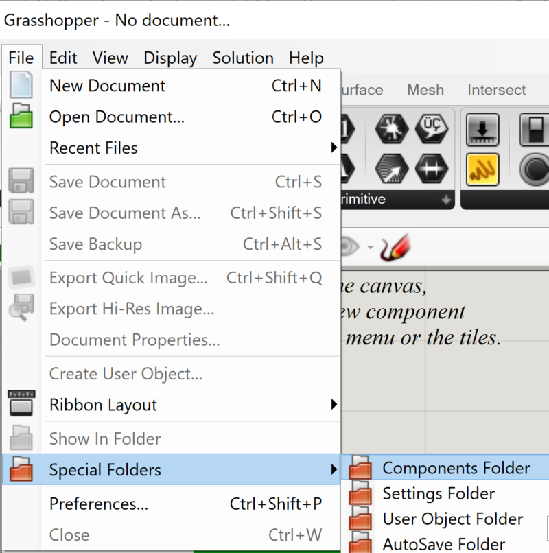
After unlocking and extracting the RequiredGHPlugins_SimAUD19.zip archive, copy the “SimAUD19 components” folder into the grasshopper component folder. The grasshopper component folder can be found at:
C:\Users\YourUserName\AppData\Roaming\Grasshopper\Libraries
or via grasshopper file menu:
Install user objects
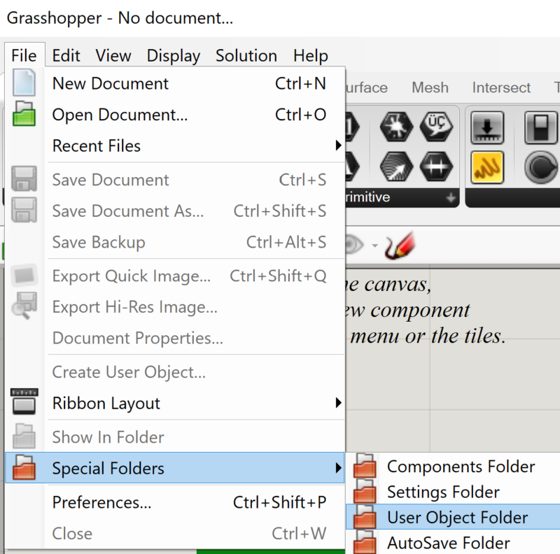
After unlocking and extracting the RequiredGHPlugins_SimAUD19.zip archive, copy the “SimAUD19 user objects” folder into the grasshopper UserObjects folder. The grasshopper component folder can be found at:
C:\Users\YourUserName\AppData\Roaming\Grasshopper\UserObjects
or via grasshopper file menu:
Enable GPU acceleration
The requirement to run the GPU accelerated street network analysis is the CUDA platform enabled NVIDIA GPU.
If this requirement is fulfilled, you have to copy the folders “Alea.CUDA.CT.LibDevice” and “Alea.CUDA.CT.Native.X86.B64.Windows” from the GPU acceleration folder to your Rhino install folder (i.e. “Program Files\Rhinoceros 6 (64-bit)\System\”).
Part 1 – Street Network Analysis
Presentation
Documentation
Interactive documentation of the Street Network Analysis toolbox.
Hands on example files:
Street Network Editing Utilities

01| CITY GRAPH STARTING EXAMPLE
Basic setup for different options how to use the street network analysis tools to calculate shortest paths and centrality measures.

04| CITY GRAPH ONE WAY ROADS
The underlying spatial graph is directed one, which means that to every street we can assign different distance weight in each direction. In the example we demonstrate how this can be used to model traffic regulation such as one way streets.
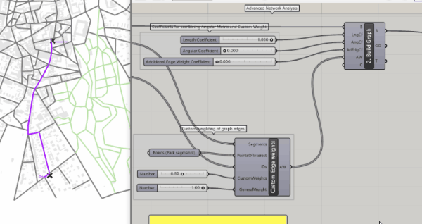
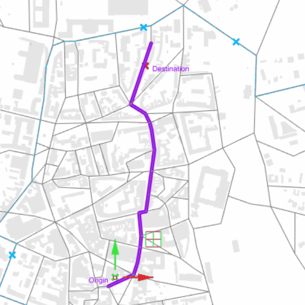
02| PARK EDGE WEIGHTING
Calculating shortest paths by assigning custom distance weights (graph edges) to the spatial network. The edge weights can be metric, angular, custom or any combination of these. Thus we can represent different concepts of distance (e.g. time, safety, cognitive distance)

05| CITY GRAPH CENTRALITY VERTEX WEIGHTING
When calculation street network centrality, we can assign custom weight to each graph vertex (origin and destination of shortest path). This can be used to model network in which some nodes (e.g. train station) produce more movement than others.
03| CITY GRAPH BUS EDGE WEIGHTING
The application of custom distance weights (edge weights) is demonstrated on the example of multi-modal transportation network. Street segment which serve as bus routes are given shorter distance representing travel time compared to pedestrian street segments.

06| CITY GRAPH CENTRALITY DISTANCE DECAY
In several centrality measures (e.g. gravity), the attractiveness of destination is inversely proportional to function of distance. As distance grows, the attractiveness is getting lower. In the street network analysis toolbox, this distance decay function can be defined by user representing different types of behavior and aversion to travel.
Street Network Editing Utilities

01| NETWORK EDITING TOOLS
To gain correct and speedy analysis results of any street network, this has to be usually simplified and corrected for drawing errors. DeCodingSpaces toolbox offers range of tools to split lines, remove duplicates, simplify intersections and remove dead ends.
02| CUSTOM OFFSET
Transforms the street network into closed polylines – street blocks which can be offseted by custom value for each block edge. We demonstrate this functionality by offseting the block edges by their respective street network centrality values.
Part 2 – Street Network Synthesis
Hands on example files:
Street Network Generation and Optimization

01| STREET NETWORK SYNTHESIS
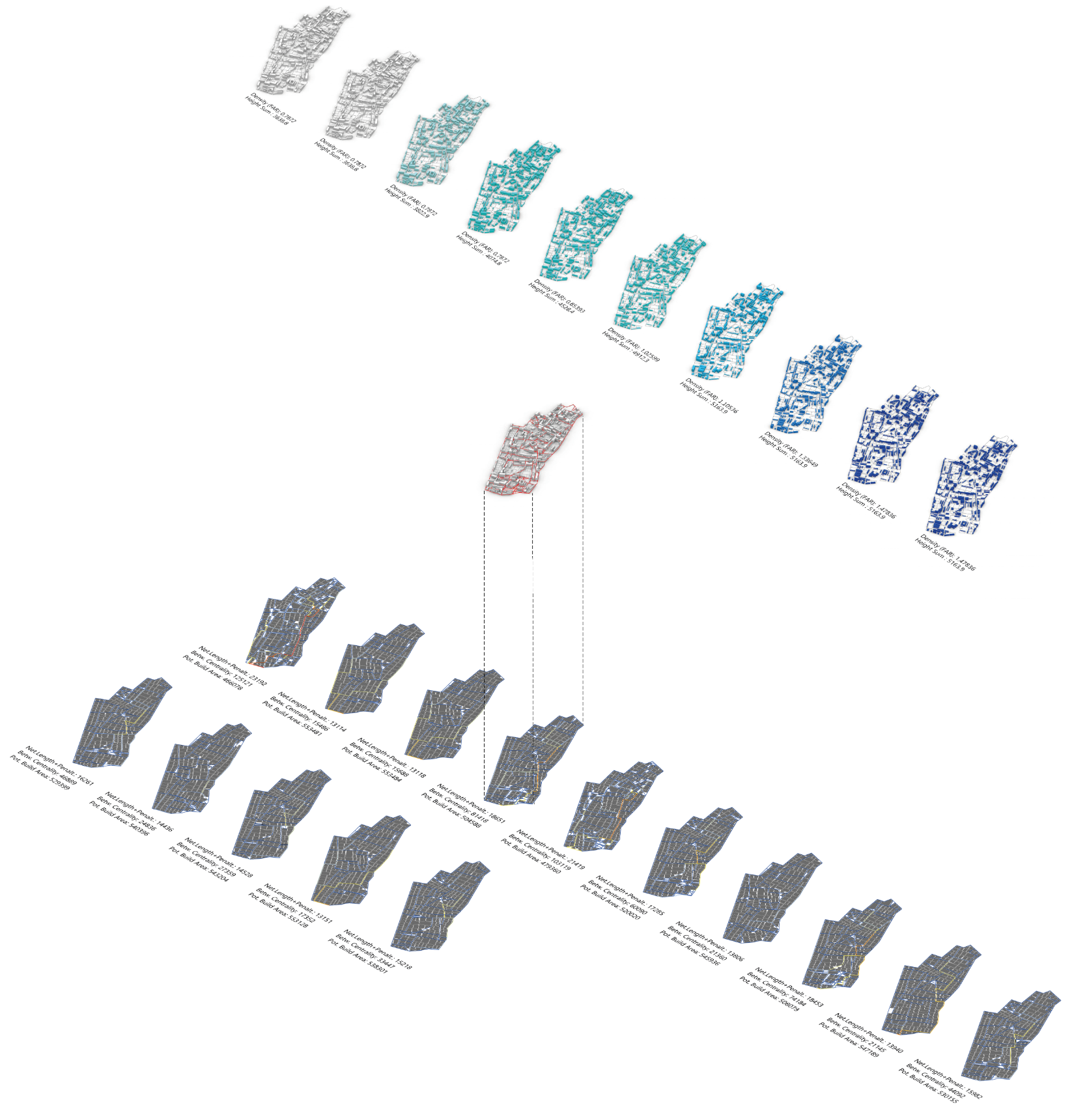
02| Chromosome Demonstration
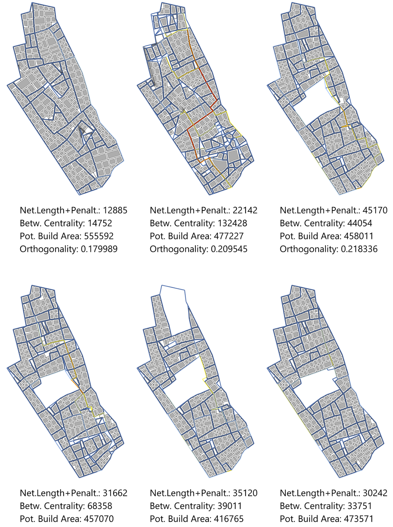
03| Evolutionary Multi-Criteria Optimization
In case you have issues with the Selector component of the DeCodingSpaces-Toolbox, it may be caused by the decimal symbol used by your operating system: make sure you use point, no comma. Second, ensure that the path to your PISA folder (part of the DeCodingSpaces-Toolbox in your libraries folder) has no space characters, points, or other special characters. You can copy the PISA folder with its content to C:\PISA and delete it from the libraries folder.
Hello! First of all thanks for all the interesting research. Your project for sure is helping lots of architects and planners. Is it possible for you to provide the link for the “Network Editing Tools” GH file? I’ve tried to download it from the links in other workshops, but it’s either pointing to a wrong file or gives me a 404 error.
Thanks!
Thanks for your positive feedback!
Concerning the download: There are problems with some browsers, but in principle it should work. I just tested it with Firefox (try right click & save…).
Reinhard, one doubt. I couldn’t get to calculate Closeness Centrality after trying to follow all the available grasshopper files (gravity GW and Betweenness BW work fine, though).
For Closeness Centrality, the list I get from the FWGetPaths is either entirely composed of “+Infinity” or all values are 0 (if I don’t insert data for Origin or Destinations).
I’m not really sure of which parameters I need to input for this analysis. Can I get some help?
I’m using the toolbox for a thesis in Politecnico di Milano. It’s a pity the university isn’t part of the initiative.
Thanks again!
Thank you for sharing such a revolutionary tool !!
I just want to know why do the decodingspace tool’s tab only shows 3 utilities in my grasshopper (I have the latest version of rhino). My tab is missing the essential of the decodingspace tools. can you help me fix this issue?
Thank you in advance
Did you follow the installation instructions and the troubleshooting hints on the main page: https://toolbox.decodingspaces.net/ ?
Do you get an error while loading Grasshopper and its plugins? Tabs are missing if something goes wrong with loading the required libraries. Check if you use the latest service release of Rhino as well.
finally it works!!! thank you very much Mr. Koenig!
Hi
Great work but i can’t find DSEGrasshopper compenent anywhere in http://infar-vm.architektur.uni-weimar.de/dse2/dse the website does’t work or i cannot get access in my country
can you please help me to get it
Thanks in advance
Nice work !
This one works:
http://infarapp.architektur.uni-weimar.de/dse2/
At the top, there is the “DSE Home Page” link.
Best regards
Reinhard
Hello,
I am getting an error with selection component. Can you please help with the issue.
Thanks
hi i need some urgent solution
i install these plugin according to the instruction but when i open the grasshopper show this picture and component is also less than original
hi i need some urgent solution
i install these plugin according to the instruction but when i open the grasshopper show this picture and component is also less than original
https://discourse.mcneel.com/t/the-grasshopper-decoding-space-and-termit-nest/115912
Hi uzair, I cannot say where this issues comes from. Maybe the Termite Nest plug-in causes conflicts with some library that we use.
hi
I copied the python component for the wasp plugin requirement then this problem is start python loading error